![]()
![]() Digital Orthoimagery - SpatialInfo
serves as a distributor of VARGIS digital aerial imagery.
Digital Orthoimagery - SpatialInfo
serves as a distributor of VARGIS digital aerial imagery.
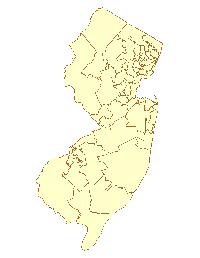
![]() Political Boundary Data - SpatialInfo maintains
current district boundaries for mapping and Geographic Information Systems (GIS). Congressional,
State House, and State Senate boundaries.
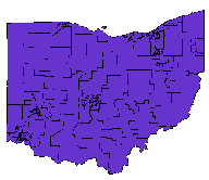
Political Boundary Data - SpatialInfo maintains
current district boundaries for mapping and Geographic Information Systems (GIS). Congressional,
State House, and State Senate boundaries.
Upon request, the firm will create Voter Precinct (Election District) boundaries. Mail for more information.
All prices are subject to change and do not include shipping and handling fees. To order, mail SpatialInfo at Sales Department.
State Senate District Sample: |
State House District Sample:
|
Note: ArcView and Atlas GIS are registered trademarks of ESRI, Inc. MapInfo is a registered trademark of MapInfo Corporation. Windows is a trademark of Microsoft Corporation.
[How does geographic information relate to my
business?]
[Digital Data Products] [Why SpatialInfo?] [How SpatialInfo Serves Specific Industries]
Copyright © 1999 SpacialInfo